
The San Fernando Valley is one of the most significant suburban landscapes in the United States — a broad, flat basin roughly 260 square miles in area that sits immediately north of the Santa Monica Mountains and encompasses approximately 1.8 million residents across the incorporated portions of the City of Los Angeles and a ring of independent municipalities including Burbank, Glendale, San Fernando, and the unincorporated communities of Los Angeles County.
For Woodland Hills residents, West Valley property owners, and anyone navigating the transportation, commerce, and daily logistics of life in the Valley’s western communities, understanding the regional geography, infrastructure, and movement patterns that define the San Fernando Valley provides essential context for one of Southern California’s most economically and demographically significant urban regions.
The Valley’s Geography and Street Grid
The San Fernando Valley’s defining physical characteristic is its flatness — a broad alluvial plain deposited over millennia by the Los Angeles River and its tributaries that drains the surrounding mountains and that creates the uniform topography underlying the Valley’s street grid.
This flat terrain enabled the regular grid development that characterizes most of the Valley’s residential and commercial fabric, with the major east-west boulevards — Ventura, Victory, Sherman Way, Roscoe, and Nordhoff — running parallel at roughly one-mile intervals while north-south arterials like Sepulveda, Reseda, Topanga Canyon, and De Soto provide the cross-corridor connections that link the grid’s horizontal segments.
The Valley’s mountain boundaries — the Santa Monica Mountains to the south, the Santa Susana Mountains to the northwest, the San Gabriel Mountains to the northeast, and the Verdugo Mountains to the east — create the basin’s defining geography and the chokepoints that concentrate through-traffic onto the limited number of freeway and road corridors that cross these mountain ranges.
The Los Angeles County Metropolitan Transportation Authority maintains the transit network and mapping resources that document the Valley’s transportation infrastructure, providing the regional context for understanding how residents and goods move through one of the country’s most car-dependent metropolitan landscapes.
Freeway Infrastructure and Traffic Patterns
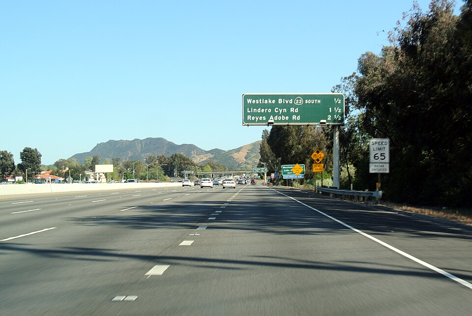
The San Fernando Valley’s freeway system — centered on the Ventura Freeway (US-101) running east-west through the Valley’s southern corridor and the San Diego Freeway (I-405) crossing the Santa Monica Mountains through the Sepulveda Pass — represents the primary arterial infrastructure through which regional traffic moves into, out of, and across the basin.
The 101 corridor through the Valley serves as the primary connection between the western Valley communities and downtown Los Angeles, Hollywood, and the Eastside — carrying the commuter volume, commercial freight, and regional through-traffic that makes the Ventura Freeway one of the most congested corridors in the Los Angeles metropolitan area during peak hours.
The 405 through the Sepulveda Pass connects the Valley to the Westside communities of West Los Angeles, Culver City, and ultimately LAX — a crossing that ranks among the most notoriously congested freeway segments in the United States, where peak hour travel times between the Valley floor and the Westside can extend to multiples of the off-peak baseline.
The California Department of Transportation — Caltrans — maintains the state highway system including the Valley’s freeway network, providing current conditions data and long-term infrastructure planning documentation that shapes how transportation investment decisions are made across the Los Angeles Basin.
The West Valley’s Commercial and Industrial Logistics
Woodland Hills and the broader West Valley communities — including Warner Center, Canoga Park, West Hills, and Chatsworth — form a distinct subregion within the San Fernando Valley whose commercial and industrial character reflects the post-World War II suburban development patterns that transformed the western Valley from agricultural land into one of the Los Angeles region’s most significant suburban employment centers.
Warner Center, developed as a planned mixed-use employment district in the 1970s and 1980s, concentrates office, retail, and hospitality uses in the Warner Center District that serves as the West Valley’s primary commercial hub and the anchor for the residential neighborhoods surrounding it.
The industrial and light manufacturing corridor along the Chatsworth and Canoga Park sections of the Valley floor — concentrated along Nordhoff Street, Roscoe Boulevard, and the rail corridor that runs through the northern Valley — represents a significant logistics and distribution component of the West Valley economy whose freight movement patterns contribute to the commercial vehicle traffic on the Valley’s arterial road network.
According to NOAA climate data for the Woodland Hills area, the western Valley experiences a Mediterranean climate with average July highs near 95°F — substantially warmer than coastal Los Angeles — and annual precipitation of approximately 17 inches concentrated between November and April, creating the seasonal commercial cycle that affects outdoor logistics, construction activity, and the residential moving patterns that concentrate in the Valley’s drier summer months.
The Santa Monica Mountains and Malibu Access Corridor
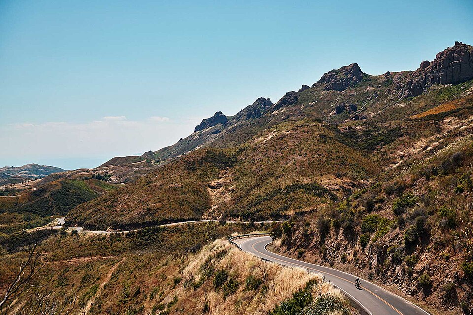
The Santa Monica Mountains form the definitive geographic boundary between the San Fernando Valley and the coastal communities of Malibu and the Pacific Palisades — a mountain range that concentrates the traffic connecting the Valley’s 1.8 million residents to the coast onto a limited number of canyon roads and freeway corridors.
Topanga Canyon Boulevard, Malibu Canyon Road, Kanan Dume Road, and the Pacific Coast Highway connections via the 101 and Las Virgenes Road represent the primary surface routes between the Valley and the Malibu coastline — routes whose narrow, winding character through sensitive mountain terrain creates the specific transportation constraints that distinguish Valley-to-coast movement from the more straightforward grid-based travel within the Valley floor.
This geographic chokepoint creates the logistical reality that defines movement between Woodland Hills and the Malibu coastal communities — whether for commuters, service providers, or the freight and logistics operations that serve both sides of the mountains.
The Santa Monica Mountains National Recreation Area, managed by the National Park Service, encompasses much of the undeveloped mountain terrain between the Valley and the coast, preserving the natural landscape that creates both the scenic quality of Malibu’s setting and the transportation constraints that make Malibu access a distinct logistical consideration for the businesses and residents who navigate it regularly.
Regional Planning and the Valley’s Future Growth
The San Fernando Valley’s regional planning context — administered through the City of Los Angeles’s planning department for the incorporated Valley communities and through Los Angeles County for the unincorporated areas — shapes how growth, density, and infrastructure investment decisions are made across one of the most populated suburban basins in the country.
The Valley’s continued population growth, combined with the transit investment that Metro’s Orange Line busway and the planned East San Fernando Valley Transit Corridor represent, is gradually reshaping the transportation options available to Valley residents — creating alternatives to the car-dependent movement patterns that have defined Valley logistics since the post-World War II suburban buildout.
For Woodland Hills residents and West Valley property owners navigating the logistics of daily life, commerce, and movement in this complex regional geography, understanding the Valley’s infrastructure, chokepoints, and planning trajectory provides the practical spatial literacy that makes navigating Southern California’s most complex suburban landscape more manageable.
Those exploring the communities, transportation networks, and regional character of Woodland Hills Los Angeles will find that the San Fernando Valley’s logistical geography shapes every dimension of life in one of the country’s most consequential suburban regions.


